Skip to content
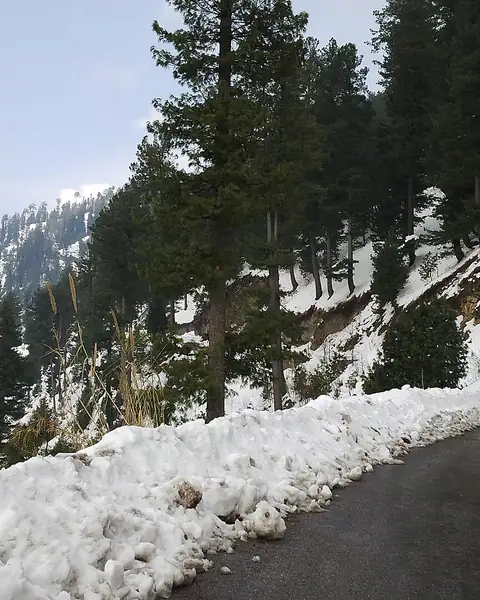
A snowy road through pine forest at Thandiani

Abbottabad, Khyber Pakhtunkhwa

Thandiani

A quiet hill station of thick forest above Abbottabad, with cool summers, snow in winter and views across the Himalayan foothills.

Altitude
2,750 m
Best months
Apr–Oct
Level
Easy
Fly into
Islamabad (ISB)

Overview

Thandiani is a small hill station about 37 km north-east of Abbottabad, perched at roughly 2,750 m. It is more densely forested than most hill stations in the area, with pine, fir and oak woods, and its name is said to come from the word for cold. The air is cool even in midsummer, and the quiet makes it a welcome change from busier resorts.

The town was a summer retreat from colonial times, with a rest house, a church and a few old houses. Today it has simple hotels and guesthouses, a small bazaar and walking paths into the forest. On clear days, there are views towards the Kashmir mountains and the plains around Abbottabad. In winter, snow falls and the road turns into a white tunnel of trees.

Highlights

  • Thick pine, fir and oak forest
  • Forest walks and viewpoints over the Himalayan foothills
  • Quiet nights and cool summer weather
  • Snow in winter, with seasonal road care needed

Best time to visit

April to October is the most comfortable period, with cool summers and clear autumn skies. Snow arrives in winter, usually from December to February, and the road can be icy. Weekends are busy, so midweek is quieter.

  1. JanJanuary: Not ideal
  2. FebFebruary: Not ideal
  3. MarMarch: Good
  4. AprApril: Best
  5. MayMay: Best
  6. JunJune: Best
  7. JulJuly: Good
  8. AugAugust: Good
  9. SepSeptember: Best
  10. OctOctober: Best
  11. NovNovember: Not ideal
  12. DecDecember: Good

● Best · ○ Good · blank: not ideal. Conditions vary by year, so check local forecasts and access before you go.

Getting there

Fly to Islamabad (ISB) and drive to Abbottabad, about two hours. From Abbottabad, a winding mountain road climbs for about an hour to Thandiani. Taxis and shared vehicles run from the city. In snow, check road conditions and carry chains.

What to expect

Facilities are simple, with small hotels and tea stalls, and fewer services than the larger hill stations. The road is narrow and steep, with many bends. Weather changes quickly, with fog and rain common in summer.

Practical tips

  • Check the road and weather before you travel, especially in winter.
  • Carry warm clothing even in summer.
  • Book a room in advance for summer weekends and snow days.
  • Respect the forest: stay on paths and avoid lighting fires.

Frequently asked questions

How far is Thandiani from Abbottabad?

About 37 km by road, around one hour or a little more depending on traffic.

Does Thandiani get snow?

Yes, usually in winter. Roads can be difficult, so check conditions and drive carefully.

Is it good for a day trip?

Yes, from Abbottabad or Islamabad, though a night at the top is more relaxing.

Official sources

Rules, fees, permits and conditions change. Check the official pages below before you travel.

Photos
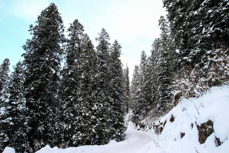
Snow-laden spruce trees at Thandiani in winter
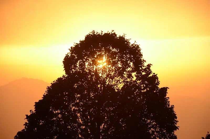
Sunset glowing behind a tree at Thandiani

Last reviewed October 2026. Details are for planning only and can change; confirm access, permits and conditions with official sources before you travel. Spotted something out of date? Tell us. Photography: Tanveer Maalik (CC BY-SA 3.0) via Wikimedia Commons, Abdullah Khalid (CC BY-SA 4.0) via Wikimedia Commons, Waqar Rasheed (CC BY-SA 3.0) via Wikimedia Commons.

Where to stay

Where to stay in Thandiani

Hotels in Thandiani are coming soon

We are adding the hotels, guesthouses and lodges that local owners register with us. Each one is reviewed before it appears here. Meanwhile, you can compare stays on our partner sites.

List your hotel Compare stays (opens a partner site in a new tab)

More in Pakistan

Keep exploring Pakistan

Snow under tall trees at Nathia Gali

Galiyat, Abbottabad, Khyber Pakhtunkhwa

Nathia Gali

A cool pine-forest hill station in the Galiyat hills, with colonial-era buildings and walks, about two and a half hours from Islamabad.

2,500 m · Apr–Oct · Easy

Good for: Scenic views · Villages & culture

Pine forest hills wrapped in cloud above Dunga Gali

Galiyat, Abbottabad, Khyber Pakhtunkhwa

Dunga Gali

A quiet pine-forest hill station in the Galiyat, with the well-known Pipeline Track walk and trails to Miranjani.

2,500 m · Apr–Oct · Easy

Good for: Scenic views · Trekking

Dark pine forest on misty hills in Ayubia National Park

Galiyat, Abbottabad, Khyber Pakhtunkhwa

Ayubia National Park

A small national park of pine and fir forest in the Galiyat hills, known for its chairlift, walking trails and leopards.

2,400 m · Apr–Oct · Easy

Good for: Scenic views · Trekking

Pines and snow-dusted slopes on the Miranjani trek

Galiyat, Abbottabad, Khyber Pakhtunkhwa

Miranjani Trek

A forest and ridge hike to the highest peak of the Galiyat, with wide views over Kashmir and the Himalayan foothills.

2,992 m · Apr–Oct · Moderate

Good for: Trekking · Scenic views

The brick walls of the Red Fort at Muzaffarabad above the Neelum River

Muzaffarabad, Azad Jammu and Kashmir

Red Fort, Muzaffarabad

A 17th-century brick fort on a rocky spur above the Neelum River, known locally as the Rutta Qila.

740 m · Mar–Nov · Easy

Good for: Villages & culture

Muzaffarabad and the river valley below forested hills

Azad Jammu and Kashmir

Muzaffarabad

The capital of Azad Kashmir, set where the Neelum and Jhelum rivers meet, and the gateway to the Neelum Valley.

700 m · Mar–Nov · Easy

Good for: Villages & culture · Scenic views

Snow on the ridge at Pir Chinasi with the shrine buildings

Near Muzaffarabad, Azad Jammu and Kashmir

Pir Chinasi

A high ridge above Muzaffarabad with a Sufi shrine, a viewpoint and cool, misty air, popular for day trips and for its snow in winter.

2,900 m · Apr–Oct · Easy

Good for: Scenic views · Villages & culture

Cable cars above pines on the Patriata chairlift

Murree, Punjab

Patriata (New Murree)

A forested hilltop above Murree with a chairlift, a cable car and wide views over the foothills.

2,250 m · Apr–Oct · Easy

Good for: Scenic views

Snow and pine forest at Murree with distant mountains

Murree, Punjab

Murree

The classic hill station of the Pir Panjal foothills, an easy two hours from Islamabad, with the Mall Road, pine forest and winter snow.

2,200 m · Mar–Nov · Easy

Good for: Scenic views · Snow & ski

A green mountain slope and pines near Ganga Choti

Bagh, Azad Jammu and Kashmir

Ganga Choti and Sudhan Gali

A high peak of the Pir Panjal with an easy-to-reach meadow base at Sudhan Gali, popular for day treks and camping.

3,045 m · May–Oct · Moderate

Good for: Trekking · Scenic views

The Kunhar River below forested slopes at Balakot

Mansehra, Khyber Pakhtunkhwa

Balakot

The river town at the foot of the Kaghan Valley, where the mountain road begins and the Kunhar River comes out of the hills.

1,000 m · Mar–Nov · Easy

Good for: Scenic views

A green slope below a snowy peak at Siri Paye above Shogran

Kaghan Valley, Khyber Pakhtunkhwa

Shogran and Siri Paye

A cool forest plateau above the Kaghan Valley, with a jeep ride to the high Siri Paye meadows and the slopes of Makra Peak.

2,362 m · Apr–Oct · Easy

Good for: Scenic views · Trekking

See all 114 places in Pakistan