Skip to content
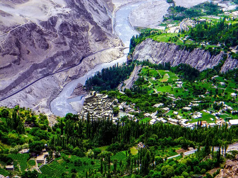
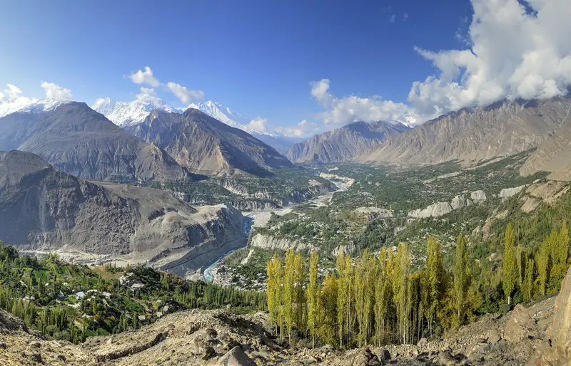
The Hunza Valley and its poplar trees seen from the Eagle's Nest viewpoint

Above Karimabad, Hunza, Gilgit-Baltistan

Eagle's Nest, Duikar

A hilltop viewpoint above Karimabad with a wide view of the Hunza Valley and the peaks around it.

Altitude
2,850 m
Best months
Apr–Oct
Level
Easy
Fly into
Islamabad (ISB)

Overview

Duikar is a hamlet on a ridge high above Karimabad, and the Eagle's Nest is the name given to its viewpoint, where a few small hotels and terraces look out over the valley. On a clear morning you can see Rakaposhi, Diran, Ultar Sar, Golden Peak and a long line of other Karakoram summits, with the Hunza River far below.

Most people come for sunrise or sunset, driving up a steep road from Karimabad and staying a night, or returning the same day. The views change with the light: at dawn the high peaks glow pink and gold, and by evening the valley fills with shadow. It is a simple place, built around the view.

Highlights

  • Sunrise and sunset over Rakaposhi, Diran and Ultar Sar
  • A panorama of the Hunza Valley from above
  • A night in a hilltop hotel, away from the village noise
  • Star-filled skies on clear nights

Best time to visit

April to October is the main season. Spring and autumn give the clearest air, and October adds colour in the valley. In winter the road can be icy and the nights are very cold, so check conditions before you plan a stay.

  1. JanJanuary: Not ideal
  2. FebFebruary: Not ideal
  3. MarMarch: Not ideal
  4. AprApril: Good
  5. MayMay: Best
  6. JunJune: Best
  7. JulJuly: Best
  8. AugAugust: Best
  9. SepSeptember: Best
  10. OctOctober: Best
  11. NovNovember: Not ideal
  12. DecDecember: Not ideal

● Best · ○ Good · blank: not ideal. Conditions vary by year, so check local forecasts and access before you go.

Getting there

Fly to Islamabad (ISB), then to Gilgit or drive the Karakoram Highway to Hunza. From Karimabad, a jeep or taxi climbs the steep road to Duikar in around 30 to 40 minutes. Ask your hotel to arrange the car, and agree on the return trip and the waiting time.

What to expect

The road is steep, narrow and rough in places, so a local driver is the safest choice. Facilities are basic, with a handful of hotels and simple meals, and mornings can be cold even in summer.

Practical tips

  • Go up for sunrise if you can: the light and the air are best early in the day.
  • Bring a warm jacket and a hat, because it is much colder up there than in Karimabad.
  • Agree the taxi price, the waiting time and the return trip before you leave.
  • Clouds can hide the peaks. If you can spare a second morning, try again.

Frequently asked questions

Why is it called the Eagle's Nest?

The name comes from its position, high on a ridge above the valley. It is used for the viewpoint and the hotels around it.

Is it better at sunrise or sunset?

Both are good. Sunrise is usually clearer and quieter, while sunset gives a warm light on the peaks. Many guests stay a night to see both.

Can I walk up from Karimabad?

It is a long, steep climb of several hours. Most visitors go by jeep, and walkers should start early, carry water and check the route with locals.

Official sources

Rules, fees, permits and conditions change. Check the official pages below before you travel.

Photos
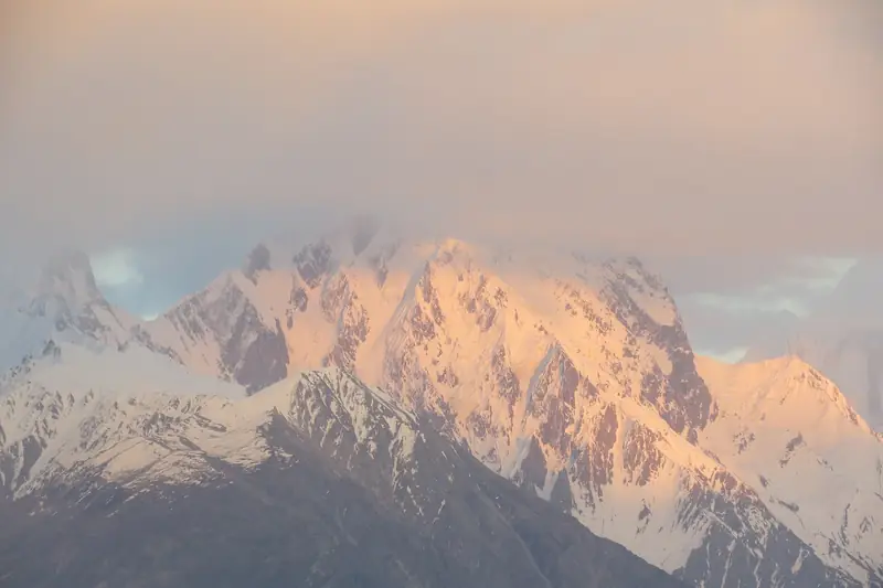
Golden light on a mountain from the Eagle's Nest viewpoint at Duikar
A green village and a river valley seen from above Duikar

Last reviewed October 2026. Details are for planning only and can change; confirm access, permits and conditions with official sources before you travel. Spotted something out of date? Tell us. Photography: Alllexxxis (CC BY-SA 4.0) via Wikimedia Commons, Fahimraza321 (CC BY-SA 4.0) via Wikimedia Commons, Tanveersalman (CC BY-SA 3.0) via Wikimedia Commons.
Where to stay

Where to stay in Eagle's Nest, Duikar

Hotels in Eagle's Nest, Duikar are coming soon

We are adding the hotels, guesthouses and lodges that local owners register with us. Each one is reviewed before it appears here. Meanwhile, you can compare stays on our partner sites.

List your hotel Compare stays (opens a partner site in a new tab)

From the journal

Plan Eagle's Nest, Duikar in more depth

More in Pakistan

Keep exploring Pakistan

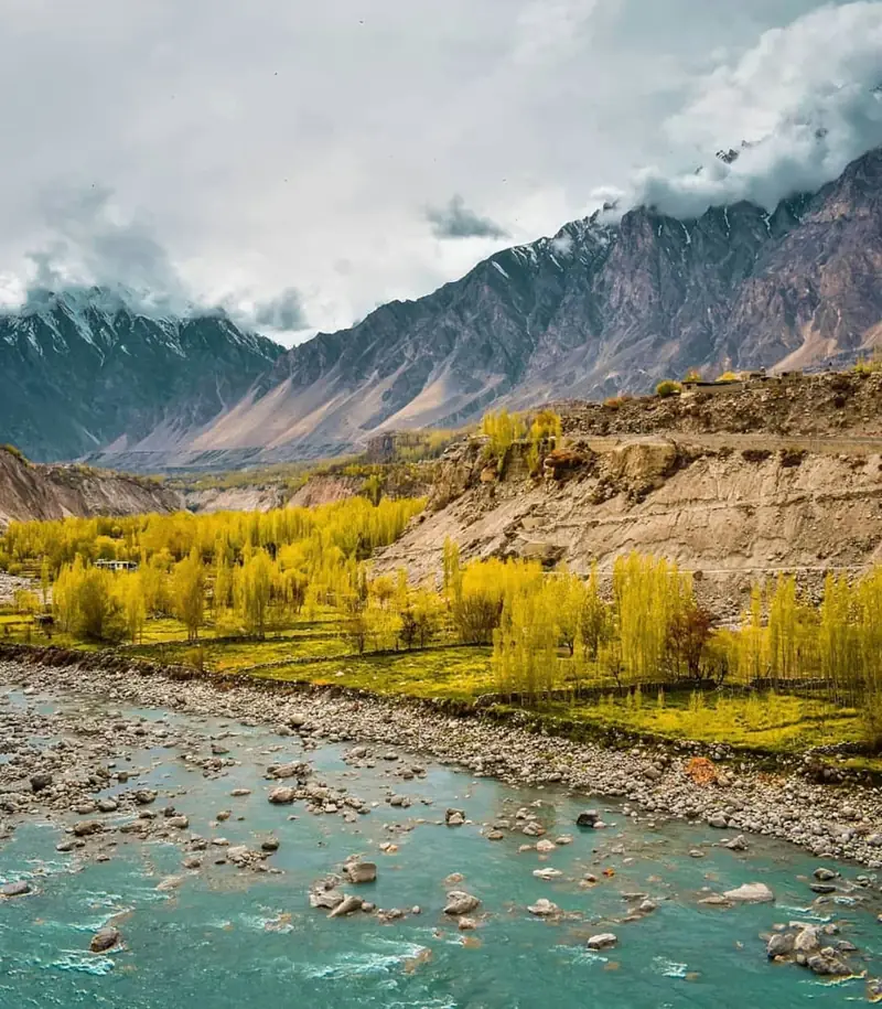
Golden poplars beside a turquoise river below Karakoram peaks

Gilgit-Baltistan

Hunza Valley

Apricot orchards, old forts and Karakoram giants along the Karakoram Highway.

2,438 m · Apr–Oct · Easy

Good for: Scenic views · Villages & culture

The wooden balconies and white walls of Baltit Fort against a blue sky

Karimabad, Hunza, Gilgit-Baltistan

Baltit Fort and Karimabad

A restored hilltop fort above Karimabad, the old home of the rulers of Hunza, with sweeping views of the valley and its peaks.

2,500 m · Apr–Oct · Easy

Good for: Villages & culture · Scenic views

Green orchards and snow peaks above the old village of Ganish in Hunza

Karimabad area, Hunza, Gilgit-Baltistan

Ganish

An old stone village beside Karimabad, known for its restored mosques, watchtower and narrow lanes.

2,400 m · Apr–Oct · Easy

Good for: Villages & culture · Scenic views

Dark cloud and snow on the steep rock faces of Ultar Sar

Above Karimabad, Hunza, Gilgit-Baltistan

Ultar Sar

A 7,388 m peak that rises above Karimabad, with a day walk towards Ultar Meadows and its glacier.

7,388 m · May–Oct · Challenging

Good for: Scenic views · Trekking

The stone walls of Altit Fort under a blue sky

Karimabad area, Hunza, Gilgit-Baltistan

Altit

A quiet village of stone houses and orchards around Altit Fort, one of the oldest buildings in the Hunza Valley.

2,100 m · Apr–Oct · Easy

Good for: Villages & culture · Scenic views

Green terraces and a river in the Chhalt valley of Nagar below snow peaks

Nagar, Gilgit-Baltistan

Nagar Valley

The green, terraced valley across the river from Karimabad, with views of Rakaposhi, glaciers and old villages.

2,400 m · Apr–Oct · Easy

Good for: Scenic views · Villages & culture

A green side valley and braided river below dry mountains in the Hopar area

Nagar, Gilgit-Baltistan

Hopar Valley

A side valley of Nagar where a glacier ends among terraced fields, facing Karimabad across the Hunza River.

2,800 m · May–Oct · Easy

Good for: Scenic views · Villages & culture

Green fields below sunlit mountains at Gulmit

Gojal, Gilgit-Baltistan

Gulmit and Ghulkin

The main village of upper Hunza, with a small museum, old houses and a glacier on the doorstep of neighbouring Ghulkin.

2,500 m · May–Oct · Easy

Good for: Villages & culture · Scenic views

The snowy west face of Rakaposhi above the Hunza Valley road

Minapin, Nagar, Gilgit-Baltistan

Rakaposhi Base Camp

A one- or two-day walk from the village of Minapin to the base camp of Rakaposhi, one of the great mountain walls of the Karakoram.

3,500 m · Jun–Sep · Moderate

Good for: Trekking · Scenic views

Turquoise water of Attabad Lake with a small boat and rocky mountain walls

Gojal, Gilgit-Baltistan

Attabad Lake

A long turquoise lake created by a landslide in 2010, now crossed by tunnels and boats on the Karakoram Highway.

2,500 m · Apr–Oct · Easy

Good for: Scenic views · Lakes

Borith Lake in a grassy hollow with mountains behind

Near Ghulkin, Gojal, Gilgit-Baltistan

Borith Lake

A small, still lake above the Hunza River, reached by a short walk and a good place to see the Passu Glacier and the cones.

2,600 m · Apr–Oct · Easy

Good for: Scenic views · Lakes

The long rope-and-plank Hussaini Suspension Bridge over the grey Hunza River below rugged peaks

Passu area, Gojal, Gilgit-Baltistan

Hussaini Suspension Bridge

A long rope-and-plank footbridge over the Hunza River, set below the Passu Cones and often photographed as a symbol of the valley.

2,500 m · May–Oct · Easy

Good for: Scenic views · Villages & culture

See all 114 places in Pakistan