Skip to content
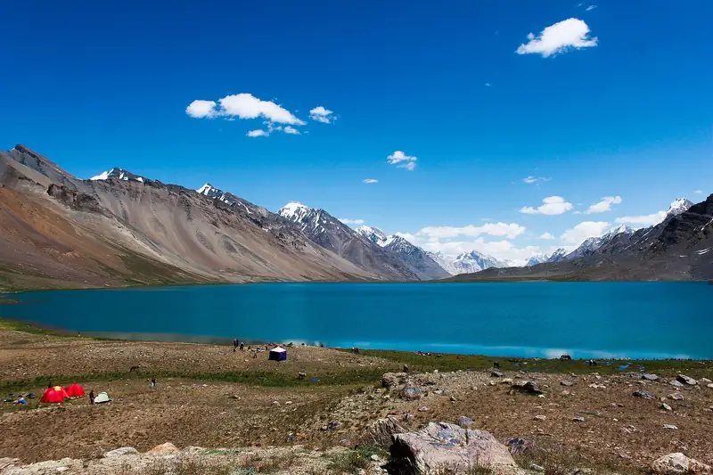
Turquoise Karambar Lake reflecting snow peaks

Karambar Pass, Gilgit-Baltistan and Khyber Pakhtunkhwa

Karambar Lake

One of the highest lakes in Pakistan, a turquoise lake near the Karambar Pass on the Gilgit-Baltistan and Chitral border.

Altitude
4,272 m
Best months
Jul–Sep
Level
Challenging
Fly into
Chitral (CJL)

Overview

Karambar Lake, also called Qurumbar, lies at about 4,300 m near the Karambar Pass, close to the border with Afghanistan. It is one of the highest lakes in Pakistan, a long sheet of turquoise water on a wide, grassy plain, with snow peaks around it. The setting is remote, with no villages for many kilometres.

The lake can be reached by a long journey up the Yarkhun Valley and into Broghil, a trip of two days or more by jeep from Chitral, or by trekking from the Ishkoman Valley in Gilgit-Baltistan. It is an expedition rather than a day trip, and visitors need local guides, camping equipment and time to adjust to the altitude.

Highlights

  • The turquoise lake in a wide high-mountain basin
  • Snow peaks and glaciers on the horizon
  • The long journey through the Yarkhun Valley and Broghil
  • Camping beside the lake under dark skies

Best time to visit

July to September is the usual season, when the roads and passes are open and the weather is more settled. Snow and cold close the area for much of the year. Check road and weather conditions with local guides and authorities before planning.

  1. JanJanuary: Not ideal
  2. FebFebruary: Not ideal
  3. MarMarch: Not ideal
  4. AprApril: Not ideal
  5. MayMay: Not ideal
  6. JunJune: Good
  7. JulJuly: Best
  8. AugAugust: Best
  9. SepSeptember: Best
  10. OctOctober: Not ideal
  11. NovNovember: Not ideal
  12. DecDecember: Not ideal

● Best · ○ Good · blank: not ideal. Conditions vary by year, so check local forecasts and access before you go.

Getting there

Fly to Chitral (CJL) from Islamabad when the weather allows, or drive via Dir. From Chitral, jeeps travel up the Yarkhun Valley via Mastuj to Broghil, a long journey of two days or more, followed by a further jeep ride or walk to the lake. The alternative approach is a trek from Ishkoman.

What to expect

This is a remote and demanding trip with long drives on rough roads, altitude above 4,000 m and very basic facilities. You need a local guide, tents and food, and the area is sensitive because of the border, so check the rules and any permits in advance.

Practical tips

  • Check current rules and any permit requirements for Broghil and the border area before you go.
  • Travel with a local guide and a driver who knows the route.
  • Acclimatise gradually: spend nights at increasing altitude on the way.
  • Carry full camping gear, warm clothing, food and water treatment.

Frequently asked questions

How high is Karambar Lake?

About 4,300 m, one of the highest lakes in Pakistan.

How long does the journey take?

Two days or more by jeep from Chitral, depending on the road, plus time to acclimatise.

Do I need a permit?

Rules for the border areas change. Ask your operator and the local authorities well before you travel.

Official sources

Rules, fees, permits and conditions change. Check the official pages below before you travel.

Photos
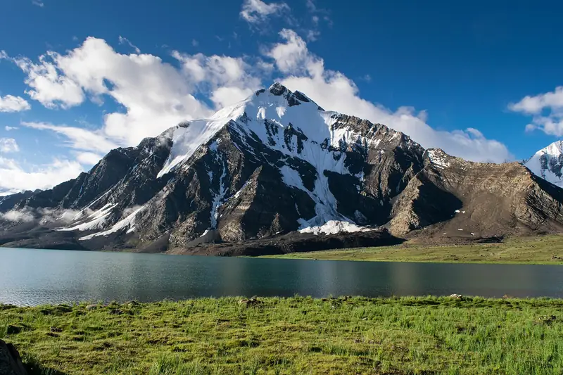
A snow-streaked peak above Karambar Lake
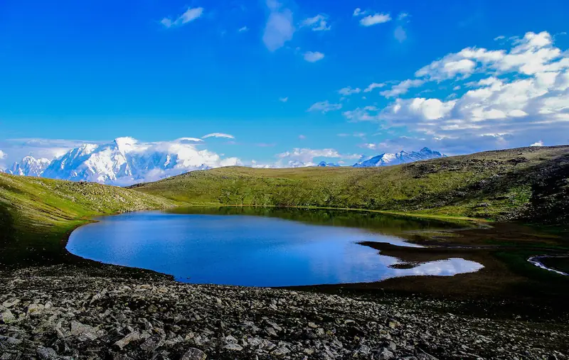
Blue water and a camp beside Karambar Lake

Last reviewed October 2026. Details are for planning only and can change; confirm access, permits and conditions with official sources before you travel. Spotted something out of date? Tell us. Photography: Talha Mahin Mir (CC BY-SA 4.0) via Wikimedia Commons, Talha Mahin Mir (CC BY-SA 4.0) via Wikimedia Commons, Hasanzubair89 (CC BY-SA 3.0) via Wikimedia Commons.
Where to stay

Where to stay in Karambar Lake

Hotels in Karambar Lake are coming soon

We are adding the hotels, guesthouses and lodges that local owners register with us. Each one is reviewed before it appears here. Meanwhile, you can compare stays on our partner sites.

List your hotel Compare stays (opens a partner site in a new tab)

From the journal

Plan Karambar Lake in more depth

More in Pakistan

Keep exploring Pakistan

Tall poplars and a sunlit meadow in the Ishkoman Valley

Ghizer, Gilgit-Baltistan

Ishkoman Valley

A green valley of potatoes, poplars and small villages in northern Ghizer, with routes to high passes and the Karambar valley.

2,100–3,700 m · May–Oct · Moderate

Good for: Scenic views · Trekking

A turquoise river and golden poplars below snowy mountains in the Yasin Valley

Ghizer, Gilgit-Baltistan

Yasin Valley

A long, quiet valley in the far west of Gilgit-Baltistan, with fields, poplars and a river below high Hindu Kush peaks.

2,400 m · May–Oct · Moderate

Good for: Scenic views · Trekking

The Ghizer River winding through green fields in the Gupis valley

Ghizer, Gilgit-Baltistan

Gupis

A green valley town on the Ghizer River, with poplars, trout and easy access to Khalti Lake and the Phander valley.

2,150 m · May–Oct · Easy

Good for: Scenic views

The green and turquoise water of Satrangi Lake in the Naltar Valley

Naltar Valley, Gilgit, Gilgit-Baltistan

Satrangi Lake

A green-and-turquoise lake in the upper Naltar Valley, reached by a rough jeep track beyond Naltar village.

3,100 m · Jun–Sep · Moderate

Good for: Lakes · Scenic views

Khalti Lake in the Gupis valley with green trees along the shore

Gupis, Ghizer, Gilgit-Baltistan

Khalti Lake

A calm lake in the Gupis valley, formed by a landslide, with poplars, a footbridge and trout in its clear water.

2,200 m · May–Oct · Easy

Good for: Lakes · Scenic views

Pine slopes and snow peaks reflected in a pool in Naltar Valley

Near Gilgit, Gilgit-Baltistan

Naltar Valley

Pine forest, coloured alpine lakes and winter skiing, a short jeep ride from Gilgit.

2,800 m · Jun–Oct · Easy

Good for: Scenic views · Lakes · Snow & ski

A broad valley with snow peaks along the road to Sost

Gojal, Gilgit-Baltistan

Sost

The last town in Pakistan on the Karakoram Highway, a customs and checkpoint stop on the way to the Khunjerab Pass and China.

2,800 m · May–Oct · Easy

Good for: Villages & culture · Scenic views

Dark cloud and snow on the steep rock faces of Ultar Sar

Above Karimabad, Hunza, Gilgit-Baltistan

Ultar Sar

A 7,388 m peak that rises above Karimabad, with a day walk towards Ultar Meadows and its glacier.

7,388 m · May–Oct · Challenging

Good for: Scenic views · Trekking

Phander Lake reflecting trees and snow-capped mountains

Ghizer, Gilgit-Baltistan

Phander Valley

A calm, green valley in Ghizer with a still lake, poplar trees and snow peaks, on the long road from Gilgit to Chitral.

2,900 m · May–Oct · Easy

Good for: Scenic views · Lakes

The Hunza Valley and its poplar trees seen from the Eagle's Nest viewpoint

Above Karimabad, Hunza, Gilgit-Baltistan

Eagle's Nest, Duikar

A hilltop viewpoint above Karimabad with a wide view of the Hunza Valley and the peaks around it.

2,850 m · Apr–Oct · Easy

Good for: Scenic views

The snowy west face of Rakaposhi above the Hunza Valley road

Minapin, Nagar, Gilgit-Baltistan

Rakaposhi Base Camp

A one- or two-day walk from the village of Minapin to the base camp of Rakaposhi, one of the great mountain walls of the Karakoram.

3,500 m · Jun–Sep · Moderate

Good for: Trekking · Scenic views

Golden poplars beside a turquoise river below Karakoram peaks

Gilgit-Baltistan

Hunza Valley

Apricot orchards, old forts and Karakoram giants along the Karakoram Highway.

2,438 m · Apr–Oct · Easy

Good for: Scenic views · Villages & culture

See all 114 places in Pakistan