Skip to content
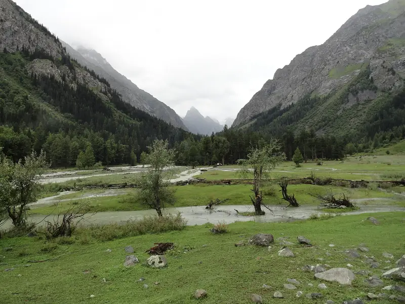
Pine-covered slopes and a river in Kumrat Valley

Upper Dir, Khyber Pakhtunkhwa

Kumrat Valley

A green valley of deodar forest and meadows beside the Panjkora River, with a jeep road to high pastures and lakes.

Altitude
2,000 m
Best months
May–Oct
Level
Easy
Fly into
Islamabad (ISB)

Overview

Kumrat lies at the head of the Panjkora River in Upper Dir, a wide valley of tall deodar forest, wide meadows and fast, clear water. The village has a few hotels and camps, and the river and trees give the area a calm, cool feel, even in midsummer.

From Kumrat, tracks lead to higher pastures such as Jahaz Banda, a meadow at about 3,100 m below the peaks, and on to Katora Lake, at about 3,500 m, a few hours further. Both can be reached by trek or on horseback with local guides, and most people allow two or three days. The area has become popular for camping, river walks and short hikes, though facilities remain simple.

Highlights

  • Deodar forest, meadows and the Panjkora River
  • Camping and river walks in the valley
  • Treks to Jahaz Banda and the high lakes with a local guide
  • Fresh mountain air and quiet nights

Best time to visit

May to October is the main season. Spring and early summer are fresh and green, July and August are busy but pleasant, and autumn is clear. The upper valley can be blocked by snow in winter.

  1. JanJanuary: Not ideal
  2. FebFebruary: Not ideal
  3. MarMarch: Not ideal
  4. AprApril: Not ideal
  5. MayMay: Good
  6. JunJune: Best
  7. JulJuly: Best
  8. AugAugust: Best
  9. SepSeptember: Best
  10. OctOctober: Good
  11. NovNovember: Not ideal
  12. DecDecember: Not ideal

● Best · ○ Good · blank: not ideal. Conditions vary by year, so check local forecasts and access before you go.

Getting there

Fly to Islamabad (ISB) or Peshawar (PEW), then drive via Dir to Kumrat, about eight to nine hours from Islamabad. The last stretch from Thall is a rough road best done by jeep. Hotels and camps in Kumrat can arrange guides and horses.

What to expect

Easy at the village, moderate for treks to high pastures and lakes. Facilities are basic, with simple hotels, tents and cabins, and signal and electricity are limited. Roads can be damaged by floods and landslides, so check conditions.

Practical tips

  • Check road conditions and local advice before you travel, as flood damage is common.
  • Book a hotel or camp in advance for summer weekends.
  • Take a local guide for treks to Jahaz Banda and the lakes.
  • Bring warm clothes: nights are cold even in summer.

Frequently asked questions

How far is Kumrat from Dir?

About 60 km, and the last part is slow because of rough roads, so allow three hours or more.

Can I camp in Kumrat?

Yes, at the camps and designated areas arranged by local hosts. Follow local advice and leave no rubbish.

Is it suitable for children?

The valley is gentle, but the road is long and rough and the trails are steep in places.

Official sources

Rules, fees, permits and conditions change. Check the official pages below before you travel.

Photos
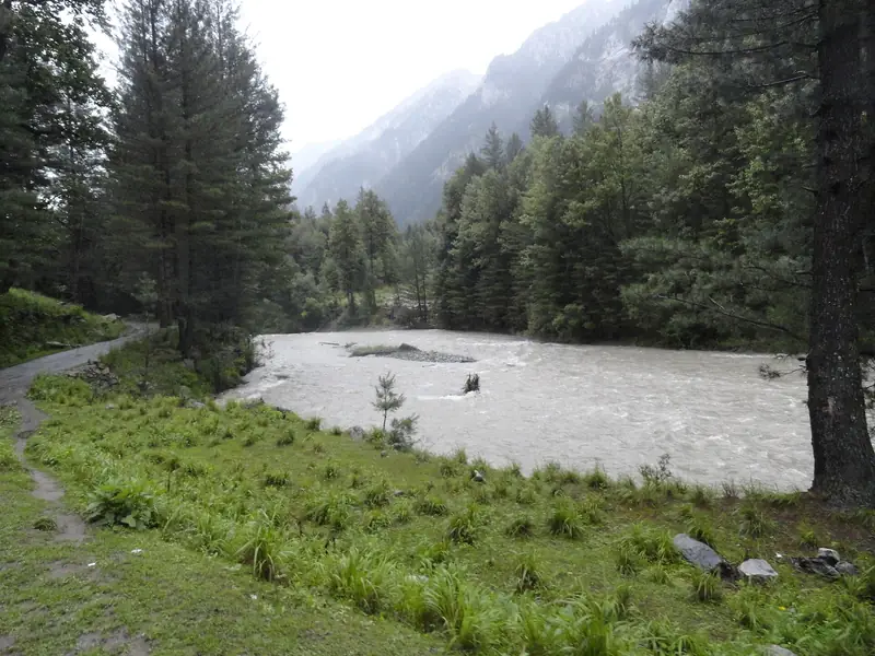
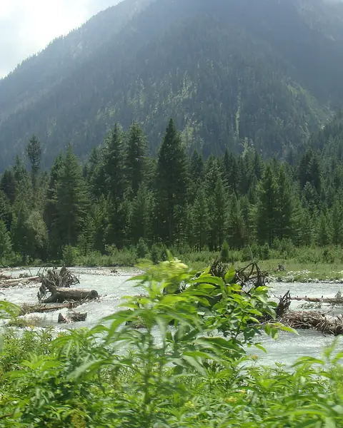
A river flowing through pines and grass at Kumrat
Meadows and mountains in the Kumrat Valley

Last reviewed October 2026. Details are for planning only and can change; confirm access, permits and conditions with official sources before you travel. Spotted something out of date? Tell us. Photography: Ziagul531 (CC BY-SA 4.0) via Wikimedia Commons, Ziagul531 (CC BY-SA 4.0) via Wikimedia Commons, Ziagul531 (CC BY-SA 4.0) via Wikimedia Commons.

Where to stay

Where to stay in Kumrat Valley

Hotels in Kumrat Valley are coming soon

We are adding the hotels, guesthouses and lodges that local owners register with us. Each one is reviewed before it appears here. Meanwhile, you can compare stays on our partner sites.

List your hotel Compare stays (opens a partner site in a new tab)

More in Pakistan

Keep exploring Pakistan

Snow and fir forest on the slopes of the Lowari Pass

Chitral and Dir, Khyber Pakhtunkhwa

Lowari Pass and Tunnel

The high pass between Dir and Chitral, with a long tunnel that opened in 2017 and a winding road with views of forest and snow.

3,118 m · Jun–Oct · Moderate

Good for: Scenic views

Green meadow and steep mountains in the Bumburet valley

Chitral, Khyber Pakhtunkhwa

Kalash Valleys

Three green valleys in the Hindu Kush, home to the Kalasha people and their distinctive festivals.

2,000 m · Apr–Oct · Easy

Good for: Villages & culture · Scenic views

Snow-capped peaks above a dry hillside in Lower Chitral

Chitral, Khyber Pakhtunkhwa

Chitral

A mountain town on the Chitral River below the Hindu Kush, with an old fort, a famous mosque and views of Tirich Mir.

1,500 m · Apr–Oct · Easy

Good for: Villages & culture · Scenic views

The orange and green-roofed Chitral Fort beside the Chitral River

Chitral, Khyber Pakhtunkhwa

Chitral Fort

The old fort of the rulers of Chitral on the river bank, famous for the siege of 1895 and still the family home of the royal house.

1,500 m · Apr–Oct · Easy

Good for: Villages & culture · Scenic views

Snow-streaked peaks above green slopes in Chitral Gol National Park

Chitral, Khyber Pakhtunkhwa

Chitral Gol National Park

A mountain park near Chitral town that protects the markhor, Pakistan's national animal, with rough trails and views down the valley.

1,450–5,000 m · Apr–Oct · Moderate

Good for: Scenic views · Trekking

A green meadow below snow peaks in upper Swat near Kalam

Swat, Khyber Pakhtunkhwa

Swat Valley and Kalam

A green, river-cut valley of forests, lakes and Buddhist ruins, with Kalam as the usual mountain base.

2,000 m · Apr–Oct · Easy

Good for: Scenic views · Lakes · Villages & culture

Clear water rushing past boulders and fir forest at Laddu in the Utror Valley

Kalam, Swat, Khyber Pakhtunkhwa

Utror Valley

A deodar and spruce valley north of Kalam, with a clear river, meadows and the lakes of Kundol and Pari.

2,300 m · May–Sep · Moderate

Good for: Scenic views · Lakes · Trekking

Jarogo Waterfall dropping down a mossy cliff in a forested gorge

Matta, Swat, Khyber Pakhtunkhwa

Jarogo Waterfall

A tall waterfall that drops down a mossy cliff in a forested gorge in the Chatekal valley of Matta, in Upper Swat.

1,500 m · May–Oct · Moderate

Good for: Scenic views

Snow-covered Tirich Mir above the green valley of Chitral

Chitral, Khyber Pakhtunkhwa

Tirich Mir

The highest peak of the Hindu Kush, a great snow mountain that dominates the skyline of Chitral.

7,708 m · Jun–Sep · Challenging

Good for: Trekking · Scenic views

The Swat River and the town of Madyan between forested mountains

Swat, Khyber Pakhtunkhwa

Madyan and Bahrain

Two river towns in the middle of the Swat Valley, with hotels, trout restaurants and bazaars on the way to Kalam.

1,350 m · Apr–Oct · Easy

Good for: Scenic views · Villages & culture

Boats on the turquoise water of Mahodand Lake

Kalam, Swat, Khyber Pakhtunkhwa

Mahodand Lake

A turquoise lake above Kalam, in a long forested valley, known as the Lake of Fishes and reached by a scenic jeep ride.

2,865 m · May–Sep · Easy

Good for: Lakes · Scenic views

A snow-capped peak above the green Matiltan Valley

Kalam, Swat, Khyber Pakhtunkhwa

Matiltan and Ushu Forest

A quiet village and forest valley above Kalam, with a waterfall, deodar trees and a river, on the road to Mahodand Lake.

2,300 m · May–Oct · Easy

Good for: Scenic views

See all 114 places in Pakistan