Skip to content
Flooded rice terraces in the Leepa Valley

Hattian Bala, Azad Jammu and Kashmir

Leepa Valley

A remote valley of rice terraces, apple orchards and pine forest near the Line of Control, reached by a long mountain road.

Altitude
1,900 m
Best months
May–Oct
Level
Moderate
Fly into
Islamabad (ISB)

Overview

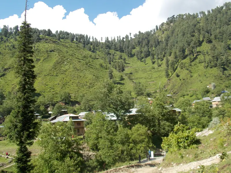
Leepa is a long, narrow valley in the Hattian Bala district of Azad Kashmir, reached from Muzaffarabad by a winding road over a high pass. The valley floor is a patchwork of rice terraces, maize and apple orchards, with pine forest on the slopes above and snow peaks at the far end. Villages of wooden houses with tin roofs sit along the stream.

The valley is remote, and the final stretch beyond Reshian is a rough jeep road. Winters bring deep snow, and in summer the weather is cool and green. The Line of Control runs near the valley, and visitors may see military posts, so rules for access, especially for foreigners, are strict and can change. Those who make the journey find a quiet, traditional landscape with warm hospitality.

Highlights

  • Terraced rice fields and apple orchards below pine forest
  • The mountain road over Reshian Gali
  • Wooden villages and local hospitality
  • Views of snow peaks along the upper valley

Best time to visit

May to October is the main season. Summer is cool and green, and rice is planted in early summer. Winter brings heavy snow, and the road is often closed. The valley is very quiet, so services may be limited outside summer.

  1. JanJanuary: Not ideal
  2. FebFebruary: Not ideal
  3. MarMarch: Not ideal
  4. AprApril: Not ideal
  5. MayMay: Good
  6. JunJune: Best
  7. JulJuly: Best
  8. AugAugust: Best
  9. SepSeptember: Best
  10. OctOctober: Good
  11. NovNovember: Not ideal
  12. DecDecember: Not ideal

● Best · ○ Good · blank: not ideal. Conditions vary by year, so check local forecasts and access before you go.

Getting there

Fly to Islamabad (ISB) and drive to Muzaffarabad, about four hours. From Muzaffarabad, the road leads to Reshian, roughly 67 km on, and then a jeep track continues to Leepa village. The whole journey takes most of a day, and a local driver and jeep are necessary for the upper stretch. Ask in Muzaffarabad about road status.

What to expect

The road is long, rough and exposed, with landslide risk, and facilities are few. Guesthouses are basic, and mobile coverage is poor. Visitors, particularly foreigners, must check current rules and security restrictions before going, as the area is close to the Line of Control.

Practical tips

  • Check the current rules and security situation in Muzaffarabad before you go.
  • Hire a local jeep and driver for the final stretch.
  • Carry cash, warm clothing and your passport or national ID.
  • Respect military areas and ask before photographing any installations.

Frequently asked questions

Is Leepa Valley open to visitors?

Domestic visitors can usually travel there, though rules change. Foreign visitors should check current regulations and permissions in advance.

How long is the journey from Muzaffarabad?

Several hours, as the road is long and rough in the final section. Plan to spend at least one night.

What is Leepa known for?

Terraced rice fields, apples and a remote, traditional way of life.

Official sources

Rules, fees, permits and conditions change. Check the official pages below before you travel.

Photos
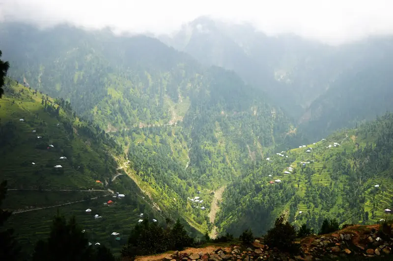
Green slopes dotted with houses in the Leepa Valley
Pine trees and houses on a green hillside in the Leepa Valley

Last reviewed October 2026. Details are for planning only and can change; confirm access, permits and conditions with official sources before you travel. Spotted something out of date? Tell us. Photography: Srhussainpk (CC BY-SA 4.0) via Wikimedia Commons, Abdul Moueed Haroon (CC BY-SA 4.0) via Wikimedia Commons, Abrar Choudhery (CC BY-SA 4.0) via Wikimedia Commons.

Where to stay

Where to stay in Leepa Valley

Hotels in Leepa Valley are coming soon

We are adding the hotels, guesthouses and lodges that local owners register with us. Each one is reviewed before it appears here. Meanwhile, you can compare stays on our partner sites.

List your hotel Compare stays (opens a partner site in a new tab)

More in Pakistan

Keep exploring Pakistan

Snow on the ridge at Pir Chinasi with the shrine buildings

Near Muzaffarabad, Azad Jammu and Kashmir

Pir Chinasi

A high ridge above Muzaffarabad with a Sufi shrine, a viewpoint and cool, misty air, popular for day trips and for its snow in winter.

2,900 m · Apr–Oct · Easy

Good for: Scenic views · Villages & culture

The Kutton weir on the Jagran River near Kundal Shahi

Kundal Shahi, Neelum Valley, Azad Jammu and Kashmir

Kutton Waterfall

A wide, roaring weir on the Jagran River beside Kundal Shahi, often called the Niagara of Kashmir.

1,350 m · Apr–Oct · Easy

Good for: Scenic views

A small waterfall among rocks near Athmuqam

Neelum Valley, Azad Jammu and Kashmir

Athmuqam

The main town of the Neelum Valley, with a bazaar, waterfalls and a base for trips to Keran, Sharda and the side valleys.

1,350 m · Apr–Oct · Easy

Good for: Scenic views

Houses among trees above the Jagran River in the Neelum Valley

Neelum Valley, Azad Jammu and Kashmir

Jagran Valley

A green side valley of the Neelum, with clear trout streams, wooden cottages and forests on steep slopes.

1,400 m · Apr–Oct · Easy

Good for: Scenic views

A grassy hilltop with pines at Toli Pir under a blue sky

Rawalakot, Poonch, Azad Jammu and Kashmir

Toli Pir

A high pine-and-grass hilltop above Rawalakot, with cool air, wide views and snow in winter.

2,743 m · May–Oct · Easy

Good for: Scenic views · Snow & ski

A green mountain slope and pines near Ganga Choti

Bagh, Azad Jammu and Kashmir

Ganga Choti and Sudhan Gali

A high peak of the Pir Panjal with an easy-to-reach meadow base at Sudhan Gali, popular for day treks and camping.

3,045 m · May–Oct · Moderate

Good for: Trekking · Scenic views

The Neelum River and terraced fields at Keran below blue mountains

Neelum Valley, Azad Jammu and Kashmir

Keran

A village on the Neelum River where the valley opens into terraces and meadows, with guesthouses facing the far bank.

1,524 m · Apr–Oct · Easy

Good for: Scenic views · Villages & culture

The brick walls of the Red Fort at Muzaffarabad above the Neelum River

Muzaffarabad, Azad Jammu and Kashmir

Red Fort, Muzaffarabad

A 17th-century brick fort on a rocky spur above the Neelum River, known locally as the Rutta Qila.

740 m · Mar–Nov · Easy

Good for: Villages & culture

Muzaffarabad and the river valley below forested hills

Azad Jammu and Kashmir

Muzaffarabad

The capital of Azad Kashmir, set where the Neelum and Jhelum rivers meet, and the gateway to the Neelum Valley.

700 m · Mar–Nov · Easy

Good for: Villages & culture · Scenic views

Forested ridges near Rawalakot seen between pine trees

Poonch, Azad Jammu and Kashmir

Rawalakot

The main town of Poonch, set in a green hill valley, and the base for Banjosa Lake, Toli Pir and the pine forests of the district.

1,600 m · Apr–Oct · Easy

Good for: Scenic views · Villages & culture

A snowy road through pine forest at Thandiani

Abbottabad, Khyber Pakhtunkhwa

Thandiani

A quiet hill station of thick forest above Abbottabad, with cool summers, snow in winter and views across the Himalayan foothills.

2,750 m · Apr–Oct · Easy

Good for: Scenic views · Snow & ski

Pine forest hills wrapped in cloud above Dunga Gali

Galiyat, Abbottabad, Khyber Pakhtunkhwa

Dunga Gali

A quiet pine-forest hill station in the Galiyat, with the well-known Pipeline Track walk and trails to Miranjani.

2,500 m · Apr–Oct · Easy

Good for: Scenic views · Trekking

See all 114 places in Pakistan