Skip to content
The Indus River below golden mountains near Chilas

Diamer, Gilgit-Baltistan

Chilas

A hot, dry town on the Indus and the Karakoram Highway, known for thousands of ancient rock carvings and inscriptions along the river.

Altitude
1,250 m
Best months
Mar–May, Sep–Nov
Level
Easy
Fly into
Islamabad (ISB)

Overview

Chilas is the main town of the Diamer district, set in a dry, rocky stretch of the upper Indus. It is the usual overnight stop on the long road between Islamabad and Gilgit, and the gateway to Fairy Meadows, Babusar Pass and the north side of Nanga Parbat.

The area is famous for its rock art. Thousands of carvings and inscriptions, left by traders, pilgrims and travellers over many centuries, cover boulders and cliff faces along the Indus. They include images of stupas, animals and Buddhist figures as well as writing in several old scripts. Some sites lie in the area of a large dam project on the river, so check which ones can be visited.

Highlights

  • The rock carvings along the Indus and the Karakoram Highway
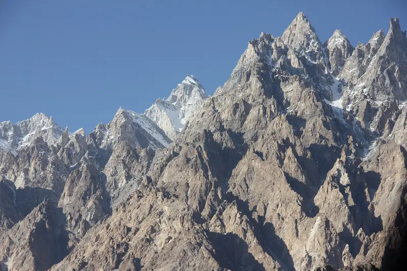
  • Views of the Indus gorge and bare brown mountains
  • The overnight stop between Islamabad and Gilgit
  • The road to Fairy Meadows and the Babusar Pass

Best time to visit

Spring and autumn are the best seasons, March to May and September to November, as summer in Chilas is very hot, often above 40°C. Winter is mild but short days limit sightseeing. Landslides can close the highway after heavy rain.

  1. JanJanuary: Not ideal
  2. FebFebruary: Good
  3. MarMarch: Best
  4. AprApril: Best
  5. MayMay: Best
  6. JunJune: Not ideal
  7. JulJuly: Not ideal
  8. AugAugust: Not ideal
  9. SepSeptember: Best
  10. OctOctober: Best
  11. NovNovember: Best
  12. DecDecember: Good

● Best · ○ Good · blank: not ideal. Conditions vary by year, so check local forecasts and access before you go.

Getting there

Fly to Islamabad (ISB) and drive the Karakoram Highway north: Chilas is about 11 to 12 hours by road from Islamabad, and three to four hours from Gilgit. Buses and shared vans run along the highway, and many travellers stay a night here.

What to expect

Chilas is a busy highway town with simple hotels and restaurants. The heat in summer is intense, and some areas have security restrictions, so take local advice. The rock art sites are open-air and need sun protection and water.

Practical tips

  • Check current security advice and any travel rules for Diamer before you plan a stay.
  • Hire a local guide to find the rock carvings and to learn what they show.
  • Do not touch or mark the carvings, and leave nothing behind.
  • In summer, travel in the early morning and rest in the heat of the day.

Frequently asked questions

Why stop in Chilas?

It breaks the long drive between Islamabad and Gilgit, and gives access to the rock art along the Indus and to Fairy Meadows.

How old are the carvings?

They span many centuries, with many dating to the early centuries AD and some older, and they were left by people travelling along the old trade routes.

Is Chilas safe for visitors?

Many travellers pass through without trouble, but conditions can change. Check official travel advice and ask your hotel before you go.

Official sources

Rules, fees, permits and conditions change. Check the official pages below before you travel.

Photos

The Karakoram Highway and the Indus near Chilas
The Indus River winding below dry brown mountains near Chilas

Last reviewed October 2026. Details are for planning only and can change; confirm access, permits and conditions with official sources before you travel. Spotted something out of date? Tell us. Photography: Adnan Wahab Khan (CC BY-SA 4.0) via Wikimedia Commons, Amersaeed218 (CC BY-SA 4.0) via Wikimedia Commons, Adnan Wahab Khan (CC BY-SA 4.0) via Wikimedia Commons.
Where to stay

Where to stay in Chilas

Hotels in Chilas are coming soon

We are adding the hotels, guesthouses and lodges that local owners register with us. Each one is reviewed before it appears here. Meanwhile, you can compare stays on our partner sites.

List your hotel Compare stays (opens a partner site in a new tab)

From the journal

Plan Chilas in more depth

More in Pakistan

Keep exploring Pakistan

A green valley seen from Babusar Pass

Kaghan Valley to Chilas, Khyber Pakhtunkhwa and Gilgit-Baltistan

Babusar Pass

A high, winding road over the mountains between the Kaghan Valley and the Karakoram Highway, with views towards Nanga Parbat.

4,173 m · Jun–Sep · Moderate

Good for: Scenic views

Deep blue Lulusar Lake below snow-streaked mountains

Kaghan Valley, Khyber Pakhtunkhwa

Lulusar Lake

A large alpine lake beside the road to the Babusar Pass, and the source of the Kunhar River.

3,410 m · Jun–Sep · Easy

Good for: Lakes · Scenic views

Wooden lodges at Fairy Meadows with the snowfields of Nanga Parbat behind

Diamer, Gilgit-Baltistan

Fairy Meadows

A grassy plateau with a front-row view of Nanga Parbat, reached by jeep and a forest trek.

3,300 m · Jun–Sep · Moderate

Good for: Trekking

The snowy ridge of Nanga Parbat above a dark pine forest

Diamer and Astore, Gilgit-Baltistan

Nanga Parbat

The ninth-highest mountain on earth, an immense snow massif that can be seen from Fairy Meadows, the Rupal valley and the Babusar road.

8,126 m · Jun–Sep · Challenging

Good for: Scenic views · Trekking

Snow slopes of Nanga Parbat above the green Rupal Valley

Astore, Gilgit-Baltistan

Rupal Valley

A high valley below the south face of Nanga Parbat, one of the tallest mountain walls in the world, with a trek to the Herrligkoffer base camp.

3,000 m · Jun–Sep · Moderate

Good for: Trekking · Scenic views

Dudipatsar Lake in a green bowl of hills

Kaghan Valley, Khyber Pakhtunkhwa

Dudipatsar Lake

A high alpine lake in a green bowl below snow peaks, reached by a long day trek from the Kaghan Valley.

3,800 m · Jul–Sep · Moderate

Good for: Trekking · Lakes · Scenic views

The rock face in Kargah Nala near Gilgit that holds the ancient Buddha carving

Near Gilgit, Gilgit-Baltistan

Kargah Buddha

An ancient standing Buddha carved into a cliff in the Kargah valley, a short drive from Gilgit.

1,500 m · Apr–Oct · Easy

Good for: Villages & culture

The Indus and Gilgit rivers meeting at Jaglot below brown mountains

Gilgit, Gilgit-Baltistan

Jaglot

A roadside junction near Gilgit where the Indus and Gilgit rivers meet and three great mountain ranges come together.

1,400 m · Mar–Nov · Easy

Good for: Scenic views

The Gilgit River and the edge of the city under dark mountains

Gilgit, Gilgit-Baltistan

Gilgit

The regional capital and main gateway to Hunza, Naltar, Skardu and the passes, with a lively bazaar and an old Buddhist rock carving nearby.

1,500 m · Apr–Oct · Easy

Good for: Villages & culture · Scenic views

Pine trees and green fields below snow peaks at Lalazar

Above Naran, Khyber Pakhtunkhwa

Lalazar Plateau

A high pine-and-meadow plateau above Naran, reached by a jeep track and surrounded by snow peaks.

3,120 m · Jun–Sep · Easy

Good for: Scenic views · Trekking

Chitta Katta Lake below dark rock peaks in the Shounter Valley

Shounter Valley, Neelum, Azad Jammu and Kashmir

Chitta Katta Lake

A remote high lake below dark rock peaks and glaciers, reached by jeep from Kel and a long hike in the Shounter Valley.

4,100 m · Jul–Sep · Challenging

Good for: Lakes · Trekking

Mountains reflected in the still water of Rama Lake

Astore, Gilgit-Baltistan

Rama Lake

A small lake in the Rama meadows above Astore, with forest slopes and snow peaks of Nanga Parbat country above it.

3,300 m · Jun–Sep · Moderate

Good for: Lakes · Scenic views

See all 114 places in Pakistan