Skip to content
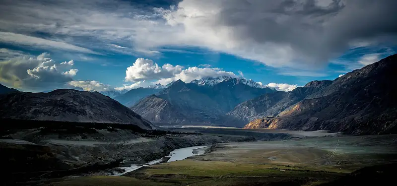
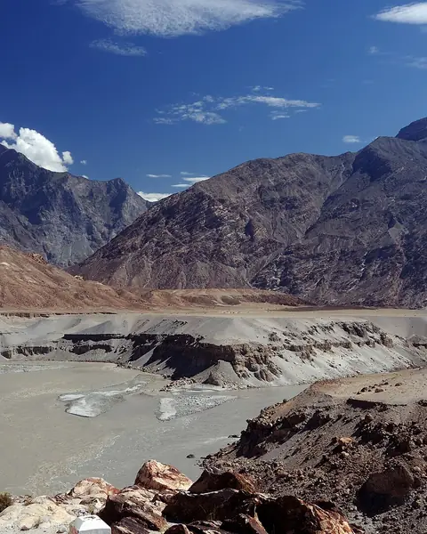
The Indus and Gilgit rivers meeting at Jaglot below brown mountains

Gilgit, Gilgit-Baltistan

Jaglot

A roadside junction near Gilgit where the Indus and Gilgit rivers meet and three great mountain ranges come together.

Altitude
1,400 m
Best months
Mar–Nov
Level
Easy
Fly into
Gilgit (GIL)

Overview

Jaglot is a small town on the Karakoram Highway about 40 km south-east of Gilgit, and it is known for a viewpoint where three of the world's greatest mountain ranges meet: the Himalaya, the Karakoram and the Hindu Kush. Nearby, the Gilgit River flows into the Indus, and the clear green water of one mixes with the muddy flow of the other in a visible line.

The junction is also the place where the road to Skardu leaves the highway and follows the Indus upstream through a deep, dry gorge. A roadside signboard and a tea stall mark the viewpoint, and most visitors stop for photographs and a short rest. The landscape is arid, with sand-coloured mountains and little shade, so it is a place for a quick stop rather than a long visit.

Highlights

  • The meeting of the Himalaya, Karakoram and Hindu Kush ranges
  • The confluence of the Gilgit and Indus rivers
  • Dramatic gorge scenery along the Skardu road
  • An easy stop between Gilgit, Chilas and Skardu

Best time to visit

It is open all year, but the best months are March to November. Summer can be very hot in the low valleys, so mornings and evenings are better. Winter is cold and dry, with clear skies.

  1. JanJanuary: Not ideal
  2. FebFebruary: Not ideal
  3. MarMarch: Good
  4. AprApril: Best
  5. MayMay: Best
  6. JunJune: Best
  7. JulJuly: Good
  8. AugAugust: Good
  9. SepSeptember: Best
  10. OctOctober: Best
  11. NovNovember: Good
  12. DecDecember: Not ideal

● Best · ○ Good · blank: not ideal. Conditions vary by year, so check local forecasts and access before you go.

Getting there

Fly to Islamabad (ISB), then to Gilgit or drive the Karakoram Highway. Jaglot is about 40 km from Gilgit, around 45 to 60 minutes by road, and it is a natural stop on the way to Skardu or Chilas. Buses and vans on the highway pass through the town.

What to expect

It is a roadside stop, so allow 20 to 30 minutes. There is little shade and the sun is strong, and services are limited to small shops and tea stalls. The roads around the junction can be busy with trucks.

Practical tips

  • Stop at the viewpoint, not on the narrow road, and watch for traffic.
  • Bring water and sun protection, especially in summer.
  • Combine with a night in Gilgit or a trip on the Skardu road.
  • Check current road conditions on the Skardu road before you set out.

Frequently asked questions

Which three ranges meet at Jaglot?

The Himalaya, the Karakoram and the Hindu Kush. The meeting point is a popular photograph stop, though the exact line is a matter of geology.

Which rivers meet there?

The Gilgit River joins the Indus near Jaglot, and the difference in colour between the two is often visible.

How far is it from Gilgit?

About 40 km, or an hour by road.

Official sources

Rules, fees, permits and conditions change. Check the official pages below before you travel.

Photos
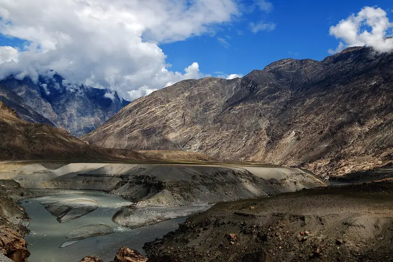
The junction at Jaglot where three great mountain ranges meet
Mountains and a wide river valley at Jaglot under storm clouds

Last reviewed October 2026. Details are for planning only and can change; confirm access, permits and conditions with official sources before you travel. Spotted something out of date? Tell us. Photography: Zacharie Grossen (CC BY-SA 4.0) via Wikimedia Commons, Rohaan Ali Bhatti (CC BY-SA 4.0) via Wikimedia Commons, Zeeshan Abbas (CC BY-SA 4.0) via Wikimedia Commons.

Where to stay

Where to stay in Jaglot

Hotels in Jaglot are coming soon

We are adding the hotels, guesthouses and lodges that local owners register with us. Each one is reviewed before it appears here. Meanwhile, you can compare stays on our partner sites.

List your hotel Compare stays (opens a partner site in a new tab)

More in Pakistan

Keep exploring Pakistan

Terraced fields and trees of a village in the Bagrot Valley below bare slopes

Near Gilgit, Gilgit-Baltistan

Bagrot Valley

A green side valley about an hour from Gilgit, with terraced villages and trails towards the base of high peaks.

2,300 m · May–Oct · Easy

Good for: Scenic views · Villages & culture · Trekking

The Gilgit River and the edge of the city under dark mountains

Gilgit, Gilgit-Baltistan

Gilgit

The regional capital and main gateway to Hunza, Naltar, Skardu and the passes, with a lively bazaar and an old Buddhist rock carving nearby.

1,500 m · Apr–Oct · Easy

Good for: Villages & culture · Scenic views

Wooden lodges at Fairy Meadows with the snowfields of Nanga Parbat behind

Diamer, Gilgit-Baltistan

Fairy Meadows

A grassy plateau with a front-row view of Nanga Parbat, reached by jeep and a forest trek.

3,300 m · Jun–Sep · Moderate

Good for: Trekking

The rock face in Kargah Nala near Gilgit that holds the ancient Buddha carving

Near Gilgit, Gilgit-Baltistan

Kargah Buddha

An ancient standing Buddha carved into a cliff in the Kargah valley, a short drive from Gilgit.

1,500 m · Apr–Oct · Easy

Good for: Villages & culture

Mountains reflected in the still water of Rama Lake

Astore, Gilgit-Baltistan

Rama Lake

A small lake in the Rama meadows above Astore, with forest slopes and snow peaks of Nanga Parbat country above it.

3,300 m · Jun–Sep · Moderate

Good for: Lakes · Scenic views

Tents among pines on a meadow with snow peaks in the Astore Valley

Astore, Gilgit-Baltistan

Astore Valley

A green valley of pine forest, meadows and small villages at the foot of Nanga Parbat, with Rama Meadows as its best-known viewpoint.

2,400 m · May–Oct · Easy

Good for: Scenic views · Trekking

The snowy west face of Rakaposhi above the Hunza Valley road

Minapin, Nagar, Gilgit-Baltistan

Rakaposhi Base Camp

A one- or two-day walk from the village of Minapin to the base camp of Rakaposhi, one of the great mountain walls of the Karakoram.

3,500 m · Jun–Sep · Moderate

Good for: Trekking · Scenic views

Rush Lake, a bright blue lake in the high mountains above Nagar

Hopar, Nagar, Gilgit-Baltistan

Rush Lake

A bright blue lake at about 4,700 m, said to be the highest alpine lake in Pakistan, reached by a demanding trek from Hopar.

4,694 m · Jul–Sep · Challenging

Good for: Trekking · Lakes · Scenic views

The snowy ridge of Nanga Parbat above a dark pine forest

Diamer and Astore, Gilgit-Baltistan

Nanga Parbat

The ninth-highest mountain on earth, an immense snow massif that can be seen from Fairy Meadows, the Rupal valley and the Babusar road.

8,126 m · Jun–Sep · Challenging

Good for: Scenic views · Trekking

The Indus River below golden mountains near Chilas

Diamer, Gilgit-Baltistan

Chilas

A hot, dry town on the Indus and the Karakoram Highway, known for thousands of ancient rock carvings and inscriptions along the river.

1,250 m · Mar–May, Sep–Nov · Easy

Good for: Villages & culture

A green side valley and braided river below dry mountains in the Hopar area

Nagar, Gilgit-Baltistan

Hopar Valley

A side valley of Nagar where a glacier ends among terraced fields, facing Karimabad across the Hunza River.

2,800 m · May–Oct · Easy

Good for: Scenic views · Villages & culture

Snow slopes of Nanga Parbat above the green Rupal Valley

Astore, Gilgit-Baltistan

Rupal Valley

A high valley below the south face of Nanga Parbat, one of the tallest mountain walls in the world, with a trek to the Herrligkoffer base camp.

3,000 m · Jun–Sep · Moderate

Good for: Trekking · Scenic views

See all 114 places in Pakistan